
Mythos
Act 2. The Tenochtitlan Map
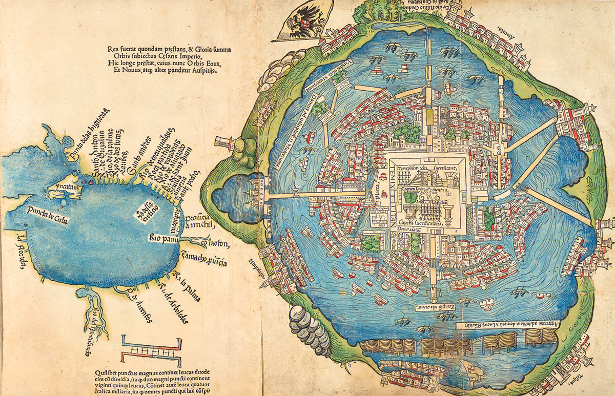
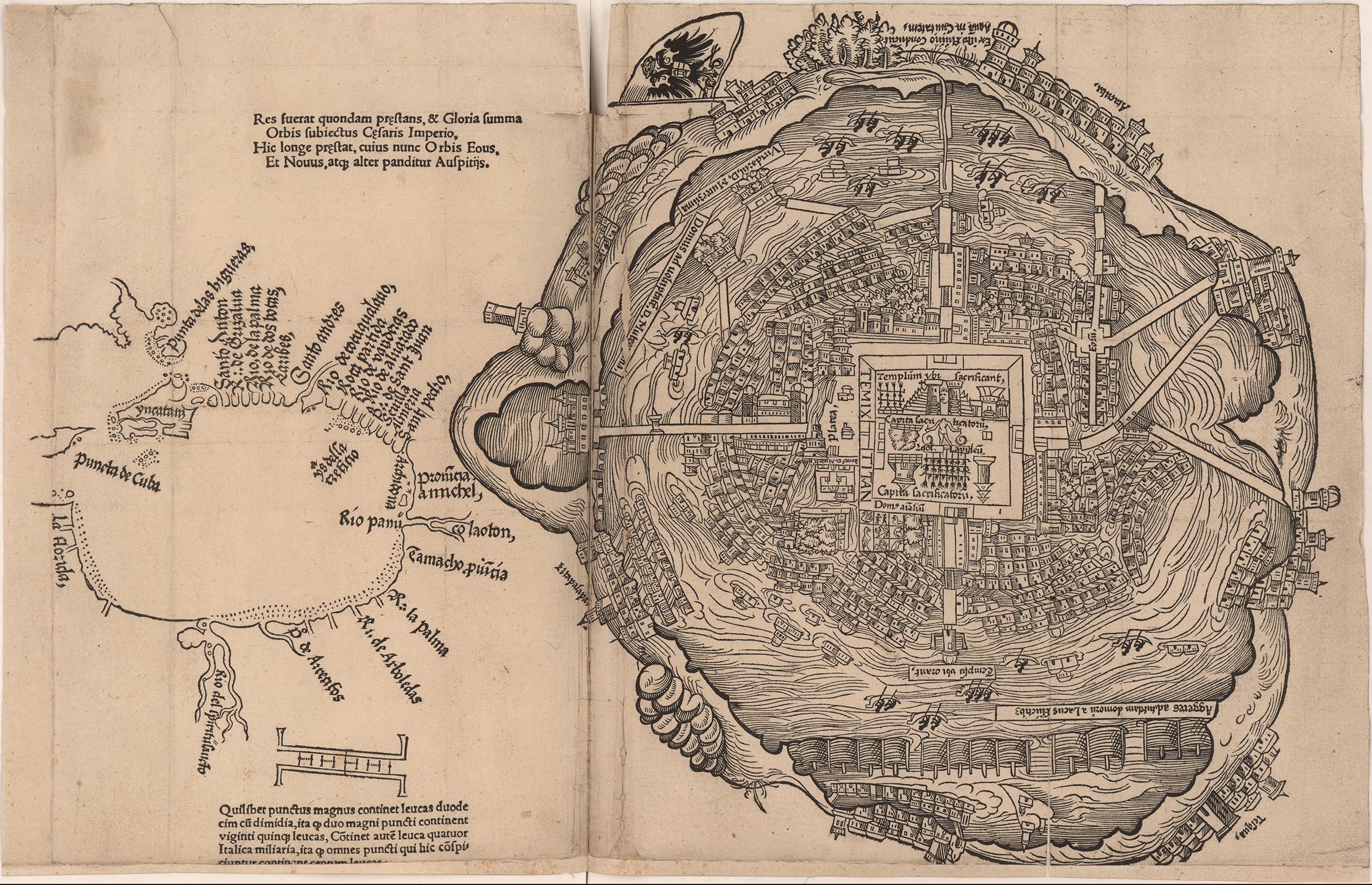
Through researching Durer and his Rhinoceros, we discovered that Durer also published a woodcut map of Tenochtitlan (pre-Hispanic Mexico City).
This map was published in 1524 by Friedrich Peypus with copies of letters written by Hernan Cortes to the Holy Roman Emperor Charles V. The imagery is attributed to Albrecht Durer, and is an interpretation of the descriptions of the Aztec city by Cortes.
Nuremberg, where Durer resided, was a center for information, cartography, weaponry, and finance. In fact, Nuremberg investors financed a great deal of Spanish colonial exploration of the New World. Spanish firsthand accounts of the New World were published in Nuremberg and disseminated throughout Europe.
Yet like the rhinoceros, Durer never saw Tenochtitlan. And, like the rhinoceros, Tenochtitlan the city was displaced by colonialism.
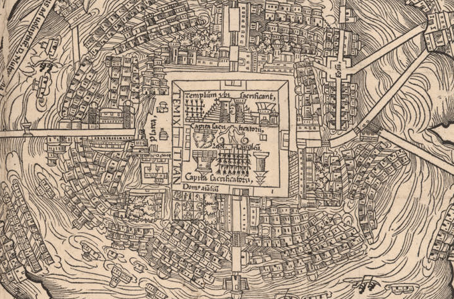
The map includes two towers – the twin sanctuaries to Tlaloc and Huitzilopochtil – framing the rising sun above the Templo Mayor, the dwellings, gardens and the zoo of Montezema, as well as buildings and causeways, and boats throughout the Lake Texcoco. The right side of the map is oriented with east at the top, with the Hapsburg double-headed eagle.
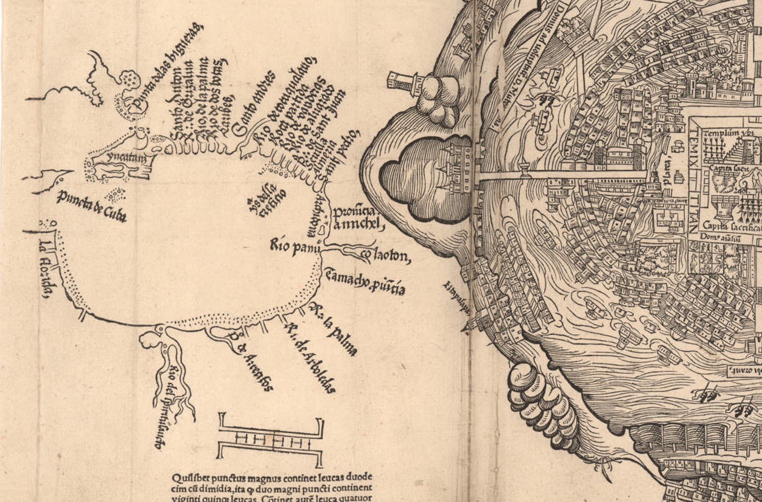
On the left side of the map, oriented with south at the top, is the Gulf of Mexico, from the Yucatan to Florida, rendered in a different scale than that of the city.
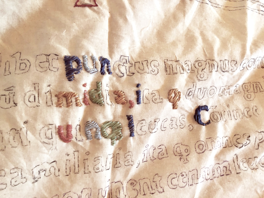
This map is the foundation for our second monumental embroidery, and will be used as a matrix for an eventual work in handmade paper.